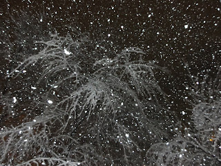
***Winter Storm Warning for Metro Area***
Major Snowfall Accumulations Expected
4:50pm EST - (PHOTO Post)
 |
| Snow rapidly accumulates in Colesville, MD (Photo By: Kenneth Lorber) |
 |
| Snow sticks to trees, roads and all surfaces in Maryland. (Photo By: Kenneth Lorber) |
4:40pm EST - (Update 5)
Heavy snow is occurring over most of the area (exception is east of I-95). Roads are quickly becoming snow covered and dangerous. Many accidents have been reported.
 |
| Valley Brook Drive at New Hampshire Ave. - Roads are hazardous and slippery. (MCDOT) |
4:05pm EST - (Update 4)
Sleet has begun to changeover to all snow here in Silver Spring, MD. There have been reports of very heavy snow just to the southwest of the area. All of this activity is now expected to continue into the evening. Heavy accumulations of 4 to 8 inches are expected.
If you have any weather photos of the storm from the DC area - send them to CapRegPulse@gmail.com
Follow us on Twitter @CapitalRegPulse and visit our Facebook page to never miss an update!
We will begin posting photos from Silver Spring in the next few updates.
3:15pm EST - (Update 3)
Thunder and lightning have been reported in parts of Fairfax County, VA! Sleet and rain will quickly change to snow and become heavy at times as bands of heavy precipitation develop and move through the area. Expect snowfall rates of 1-2 inches per hour at times into the evening hours. Latest data indicates peak snowfall period may only be 6 hours long but heavy accumulations expected during that time.
The evening commute is expected to be extremely dangerous across the area. Please drive carefully and watch all vehicles around you. Obey traffic laws and stay alert.
Storm total accumulations in the heaviest bands should be from 5-10 inches with a general 4-8 inch total elsewhere. We are currently expecting numerous school delays/closures tomorrow so stay with The Capital Region Pulse for the latest information!
2:35pm EST - (Update 2)
Weather conditions will rapidly deteriorate across the Washington area within the next one to two hours. Heavy snowfall with rates possibly reaching two inches per hours will become probable. A Winter Storm Warning remains in effect into tonight for the potential of major snowfall accumulations. It is possible that the snow may start as sleet or rain for a short period before changing to all snow.
Residents should be prepared for possible hazardous road conditions this afternoon and evening. Keep in mind that the federal government has allowed a two hour early closing.
 |
| Heavy bands of precipitation can be seen moving up from the south. |
1:45pm EST - (ORIGINAL POST)
With a Winter Storm Warning in place across the metro area, the region is preparing for a significant winter storm. Reports of heavy snowfall are already coming out of parts of Virginia, and these dynamics are expected to move into the Washington area as the afternoon progresses.
The Capital Region Pulse weather team is currently forecasting between five and nine inches of snow for the area...some higher totals will be possible in the heaviest bands.
Thundersnow will be possible with incredible snowfall rates during the heart of the storm. Don't be surprised if roads QUICKLY become impassable and extremely hazardous.
We will continue to have the latest information as it becomes available!


